Blocks and Streets Extraction
Blocks and Streets Extraction from Satellite and Aerial imagery
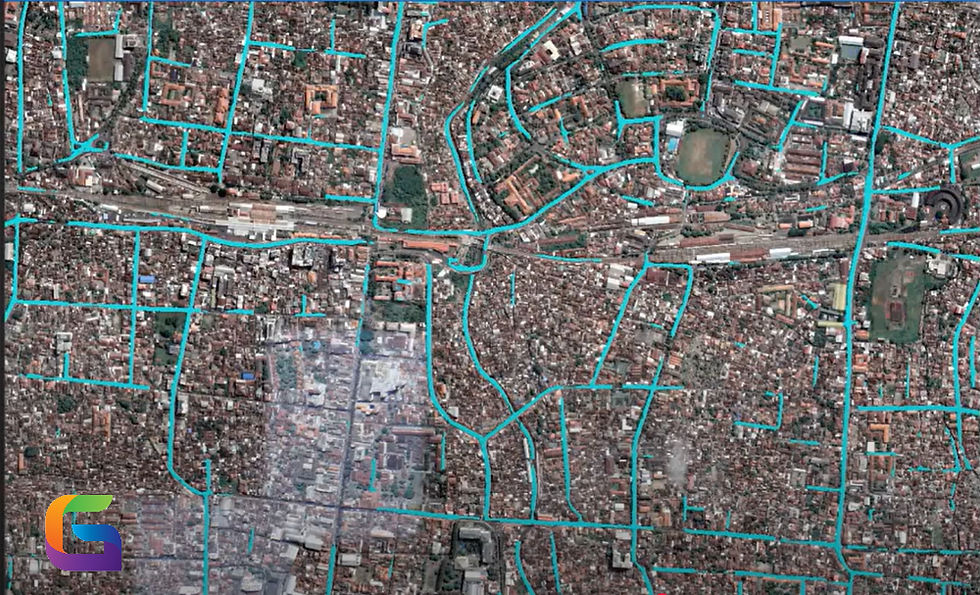
This deep learning model is designed to extract blocks and streets from high-resolution (1-meter) aerial or satellite imagery. The resulting layers are essential for creating base maps, enhancing map visualizations, and supporting various geospatial analyses.
Traditionally, digitizing blocks and streets from imagery has been a labor-intensive, manual process. However, this model leverages the power of deep learning to automate feature extraction, significantly reducing the time and effort required. By accurately learning the complex spatial patterns and semantics of urban infrastructure, the model delivers high-quality results that surpass traditional digitization methods.
Use this model to streamline your geospatial workflows and accelerate the generation of detailed, reliable mapping data.