Organic Layout
In network or link analysis, a visual arrangement of entities that emphasizes node connections, helping to reveal spatial or relational patterns.
What defines an Organic Layout?
When spatial features are placed in a natural, free-form, or irregular way instead of strictly adhering to geometric or grid-based structures, this is referred to as an organic layout in mapping and GIS. Winding roads, irregular parcel forms, and a variety of spatial distributions are the outcome of this pattern, which represents natural growth, topography, or human communities that have developed without formal design.
Older cities, rural landscapes, and natural settings frequently have organic layouts, where elements evolve over time under the influence of social dynamics, geography, and past growth patterns. Organic layouts give priority to adjusting to the current situation, in contrast to systematic or planned layouts, and provide a realistic depiction of spatial complexity and diversity.
Related Keywords
In GIS, an organic network architecture depicts naturally occurring, asymmetrical spatial linkages, such as rivers or roads, that are influenced by both human activity and the topography.
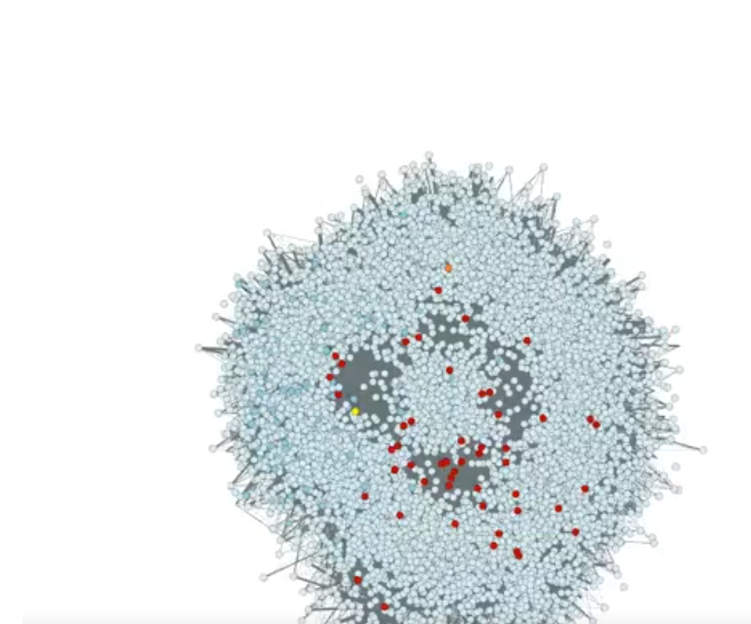
Network or graph data can be automatically arranged using the ArcGIS Organic Layout tool in a way that is both aesthetically pleasing and organic. It arranges connected nodes to reduce overlaps and edge crossings, which simplifies the interpretation of complex interactions and is modelled by biological structures. Visualizing social networks, utility systems, and other related datasets is made much easier using this style.
Natural shapes, flowing patterns, and smooth lines are used in an organic map layout design to produce maps that are aesthetically pleasing, simple to use, and easy to read.
GIS graph layout algorithms are methods for organizing spatial networks, like utility grids, social networks, or transit lines, visually so that they are simple to understand and examine. These methods minimize clutter, emphasize relationships, and enhance readability by optimizing node placement and edge routing. Planar embeddings, force-directed layouts, and hierarchical layouts are common methods that are appropriate for many geographic network types and analysis applications.