GeoJSON vs KML: A Simple Comparison Guide
- Aug 11, 2025
- 2 min read
Developers, GIS researchers, and mapping aficionados frequently have to choose between GeoJSON and KML in the rapidly changing world of geographic data formats. Although geospatial data is frequently stored and shared using both, there are notable differences in their performance, compatibility, and structure. To assist you in selecting the best format for your project, this guide offers a technical breakdown.

What is GeoJSON?
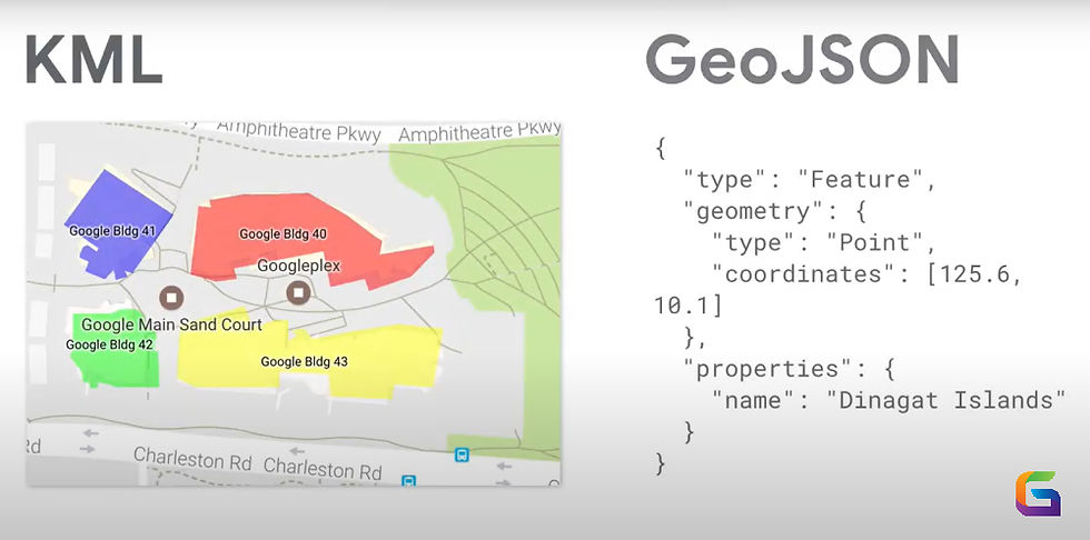
A lightweight JSON-based format called GeoJSON was created to encode several types of geographic data structures.
It adheres to the standards outlined in RFC 7946 and is based on JavaScript Object Notation (JSON).
Important aspects of GeoJSON:
Point, MultiPoint, LineString, MultiLineString, Polygon, MultiPolygon, and GeometryCollection are among the geometry types that are encoded.
Feature and Feature Support: To link properties to geometries, collect objects.
Its default coordinate reference system is WGS 84 (EPSG:4326).
Specifically made for online applications using mapping libraries such as OpenLayers, Leaflet, and Mapbox GL JS.
Example:
{
"type": "Feature",
"geometry": {
"type": "Point",
"coordinates": [77.5946, 12.9716]
},
"properties": {
"name": "Bengaluru"
}
}
What is KML?
The XML-based KML (Keyhole Markup Language) format was first created for Google Earth. Later, the Open Geospatial Consortium (OGC) standardized it.
KML's salient traits include:
Encrypts picture overlays, polygons, lines, and points.
Rich style features include balloon pop-ups, colours, opacity, and icons.
Allows for the representation of temporal data through time-based animations.
Integrates well with other GIS platforms, including Google Earth and Maps.
Example:
<Placemark>
<name>Bengaluru</name>
<Point>
<coordinates>77.5946,12.9716,0</coordinates>
</Point>
</Placemark>
Technical Comparison: GeoJSON vs KML
Feature | GeoJSON | KML |
Format Type | JSON (text-based, human-readable) | XML (text-based, verbose) |
OGC Standard | RFC 7946 | OGC KML 2.2 |
Geometry Types | Point, LineString, Polygon, Multi-geometries | Point, LineString, Polygon, MultiGeometry, Model |
Coordinate System | WGS 84 (EPSG:4326) only | WGS 84 (EPSG:4326) only |
File Size Efficiency | Smaller due to JSON compression | Larger due to XML verbosity |
Styling Support | Limited (handled mostly by mapping libraries) | Extensive (colors, icons, 3D models, labels) |
Time Support | Not native | Built-in <TimeSpan> and <TimeStamp> |
Web Integration | Excellent (native for JavaScript APIs) | Limited without conversion |
Best For | Web mapping, APIs, and real-time GIS | Visualization, Google Earth, 3D geospatial contexts |
When to Use GeoJSON
Select GeoJSON if
You are creating interactive maps for the web.
Your data is regularly updated and powered by APIs.
You need quick parsing and portable storage.
JavaScript mapping libraries are what you're working with.
When to Use KML
Select KML if
Rich visualization using 3D models, styles, and iconography is required.
Google Earth or Google Maps (with KML layers) are your target environments.
Time-based geographical events must be represented.
XML must work with older GIS systems.
KML is superior in use cases that are primarily focused on Google Earth and involve a lot of visualization, whereas GeoJSON is best suited for online and API-first applications. Your process, the platform you want to use, and the features you need will all influence your decision.
Depending on your target audience, you can export your source data to GeoJSON or KML and save it in a more neutral format (such as GeoPackage) for optimal flexibility.
For more information or any questions regarding the GeoJSON and KML, please don't hesitate to contact us at
Email: info@geowgs84.com
USA (HQ): (720) 702–4849
(A GeoWGS84 Corp Company)


Comments