TorchGeo for Beginners: Unlocking AI in Geospatial Applications
- Jun 16, 2025
- 3 min read
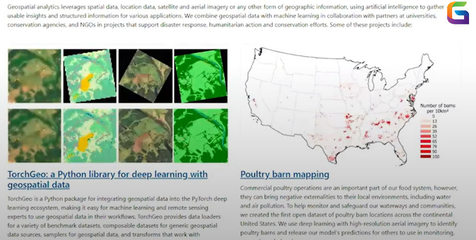
In the era of deep learning and Earth observation, integrating artificial intelligence with remote sensing data is crucial. TorchGeo is a powerful open-source Python library built on PyTorch, designed to simplify deep learning workflows for geospatial data.
Whether you are a researcher or a data scientist, TorchGeo provides a modular and scalable framework for applications like land cover classification and semantic segmentation on satellite imagery.
What is TorchGeo?
An extension of PyTorch, TorchGeo is made to work with spatiotemporal geospatial data, including raster/vector data layers, satellite images, aerial photography, and hyperspectral cubes. TorchGeo is a powerful data loading, preprocessing, and augmentation tool for training AI models on geographical datasets. It was created by Microsoft and made available under the PyTorch ecosystem.
It offers a smooth pipeline from raw data import to model deployment by supporting formats like GeoTIFF and Shapefiles and integrating with libraries like Rasterio, Torchvision, Fiona, and PyTorch Lightning.

Key Features of TorchGeo
1. Abstraction of GeoDatasets
The GeoDataset class, a spatially aware PyTorch Dataset that understands how to sample and extract tiles, windows, or patches from massive geographic datasets while preserving geolocation context, is the foundation of TorchGeo.
2. Pre-made datasets
Numerous public and research-grade datasets are natively supported by TorchGeo, including:
The National Agriculture Imagery Program (NASA NAIP)
USDA Crop Data Layer, or CDL
Multispectral Sentinel-2 Imagery
The BigEarthNet
Bay of Chesapeake Land Cover
This eliminates the burden of dataset preparation and allows you to jump directly into modelling.
3. Organize Changes
Using pyproj and rasterio, TorchGeo facilitates EPSG-based conversions. When integrating several raster and vector layers in a format that is ready for modeling, this guarantees consistent projection handling.
4. Augmenting Data
Allows for spatially aware data augmentations like
Resampling and random cropping
Flips and rotations
Noise injection in spectral channels
On limited and unbalanced geographic datasets, these are essential for increasing model robustness.
Building a Deep Learning Pipeline with TorchGeo
Here's how you can build a semantic segmentation model with TorchGeo in a few steps:
1. Dataset Initialization:
From torchgeo.datasets import Chesapeake7
dataset = Chesapeake7(root="data/", crs="EPSG:3857", res=1.0)
2. Data Splitting and Sampling
From torchgeo.samplers import RandomGeoSampler
sampler = RandomGeoSampler(dataset, size=256, length=1000)
3. DataLoader Integration
From torch.utils.data import DataLoader
dataloader = DataLoader(dataset, sampler=sampler, batch_size=4)
4. Model Architecture
Use any PyTorch-compatible CNN like UNet, DeepLabV3, or even Swin Transformers adapted for pixel-wise classification.
5. Training with PyTorch Lightning
from pytorch_lightning import Trainer
trainer = Trainer(max_epochs=20)
trainer.fit(model, dataloader)
Why TorchGeo Over Traditional GIS + ML Approaches?
Feature | TorchGeo | Traditional GIS + ML |
Deep learning native | ✅ | ❌ |
GPU-accelerated | ✅ | ❌ |
Scalable over large geographies | ✅ | ⚠️ |
Integration with PyTorch models | ✅ | ❌ |
Handles geospatial raster/vector seamlessly | ✅ | ⚠️ |
TorchGeo abstracts away the complexities of geospatial formats while allowing you to train state-of-the-art deep learning models natively in PyTorch.
For AI professionals working in the field of remote sensing, TorchGeo is a game-changer. It enables scalable and repeatable geospatial modelling pipelines by fusing the strength of GPU-accelerated deep learning with the discipline of geospatial analytics.
Learning TorchGeo is essential if you're going into AI-powered geospatial analysis. It is a whole ecosystem that connects deep learning and geodata, not just a library.
For more information or any questions regarding TorchGeo, please don't hesitate to contact us at
Email: info@geowgs84.com
USA (HQ): (720) 702–4849
(A GeoWGS84 Corp Company)


Comments