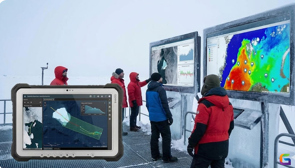
The Role of Geospatial Analysis in Mineral Exploration
- Anvita Shrivastava

- Jun 3, 2025
- 3 min read
Over the past twenty years, there has been a significant change in the field of mineral prospecting. One of the most significant developments is the use of geospatial analysis. This multidisciplinary method integrates remote sensing, spatial data modelling, GIS (Geographic Information Systems), and geostatistics to enhance targeting efficiency, reduce risk, and improve accuracy in mineral prospecting.
When it comes to mineral exploration, what is geospatial analysis?
In order to find patterns, connections, and trends related to the Earth's subsurface, geospatial analysis entails gathering, processing, and evaluating geographical data. Geospatial analysis is utilised in mineral exploration to:
Combine data from geology, geochemistry, and geophysics.
Create maps of the mineral potential that are predictive.
Carry out anomaly identification and spatial interpolation.
Assist with resource assessment and drill targeting.

Core Components of Geospatial Analysis in Exploration
1. GIS-Based Data Integration
Explorers can do the following with GIS platforms like ArcGIS, QGIS, and MapInfo:
Place several subject layers on top of one another (lithology, buildings, alteration zones, etc.).
Show the spatial links between geological features and known mineral occurrences.
For reanalysis, digitise and georeferenced historical data.
2. Remote Sensing for Lithological and Alteration Mapping
Landsat 8, Sentinel-2, ASTER, and hyperspectral imaging (AVIRIS, Hyperion) are examples of high-resolution satellite and aerial remote sensing data that are essential for:
Utilising spectral indices (such as Principal Component Analysis and Band Ratioing) to identify hydrothermal alteration zones
Using the VNIR and SWIR bands to map carbonates, clays, and iron oxides
Determining the lineaments and terrain morphology for structural interpretation
3. Geostatistical Modelling
advanced geostatistical techniques like
Kriging (Co-Kriging, Indicator, and Ordinary)
Weighting via Inverse Distance (IDW)
Gaussian Sequential Simulation (SGS)
They are employed to extrapolate geophysical and geochemical anomalies over areas with limited sampling.
By taking data uncertainty into account, these methods enable the quantitative prediction of mineral potential.
4. Machine Learning and Predictive Modelling
To forecast mineral prospectivity in uncharted regions, supervised and unsupervised machine learning models (such as Random Forest, Support Vector Machines, Artificial Neural Networks, and Fuzzy Logic) are trained using known deposits.
Important input parameters consist of:
Lithology
Intersections of structures
Minerals that are altered
gradients in geophysics
Geochemistry of soil and stream sediments
Multi-criteria decision analysis (MCDA) for exploration targeting is made possible by spatial predictive modelling tools such as ArcSDM (Spatial Data Modeller) and Python-based libraries like scikit-learn and PySAL.
Challenges and Future Directions
Despite the many advantages of geospatial analysis, there are also issues:
Data resolution and quality: Predictive accuracy is limited by low-resolution datasets and inadequate georeferencing.
Vegetation cover and terrain impacts can obfuscate signals from remote sensing.
Computational complexity: Both domain knowledge and a substantial amount of computing power are needed for high-dimensional modelling.
Future developments include:
Combining LiDAR and drone-based photogrammetry
Utilising geospatial analytics tools hosted in the cloud (like Google Earth Engine)
Analytics driven by AI and edge computing for real-time data processing
By providing data-driven, spatially precise insights that lower risk, enhance target delineation, and speed discovery, geospatial analysis is revolutionising the way geoscientists approach mineral exploration. Its significance in the digital transformation of the mineral sector will only get more crucial as technologies develop and data accessibility increases.
For more information or any questions regarding Geospatial Analysis in Mineral Exploration, please don't hesitate to contact us at
Email: info@geowgs84.com
USA (HQ): (720) 702–4849
(A GeoWGS84 Corp Company)


Comments