What is Spatial Data Analysis?
- May 29, 2025
- 3 min read
Updated: May 31, 2025
In today’s data-driven world, understanding where events occur is just as important as understanding what happens. Spatial Data Analysis offers the tools and methods needed to extract meaningful insights from geographic or location-based data. This analysis is essential in fields such as urban planning, environmental science, epidemiology, transportation, and business intelligence.
What is Spatial Data?
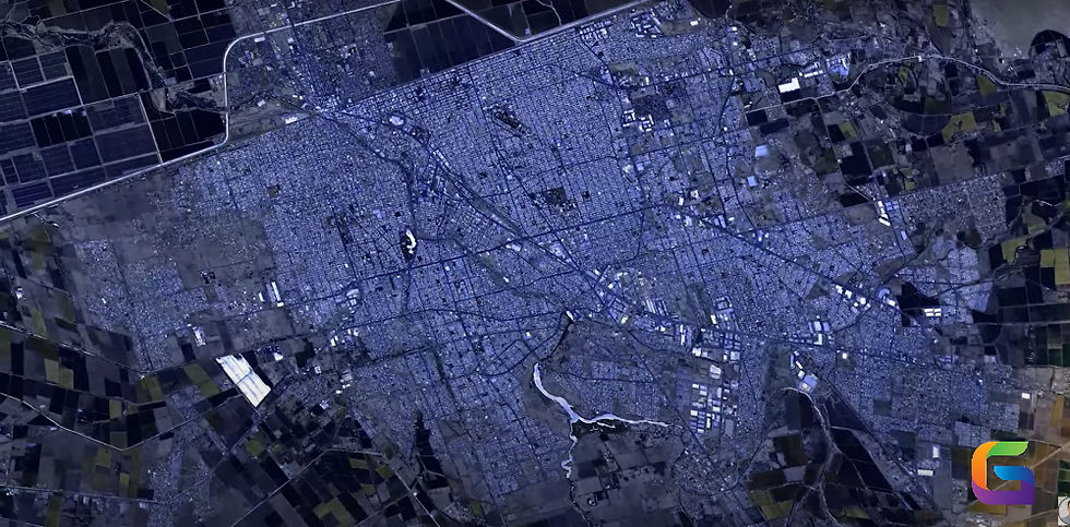
Information regarding the location and form of actual objects or features on Earth is referred to as spatial data, or geospatial data. This information may be:
Points, lines, and polygons are used to represent vector data, including city locations, road networks, and administrative boundaries.
Raster data: Shown as a grid of cells or pixels (e.g., elevation models, satellite photography).
Spatial data is perfect for in-depth research because it frequently contains related characteristics like population density, land use type, or temperature measurements.
Defining Spatial Data Analysis
Examining the locations, characteristics, and connections of features in geographic data using a range of methods is known as spatial data analysis, or SDA. To find patterns, connections, and trends, it combines geographic data with mathematical and statistical models.
Types of Spatial Data Analysis
The following categories can be used to broadly classify spatial data analysis:
1. Analysis of Descriptive Space
Gives basic spatial data information and visualisation. Among the methods are:
Charting
An overview of the statistics
Thematic mapping (e.g., choropleth maps)
2. Exploratory Spatial Data Analysis (ESDA)
Focuses on discovering patterns or anomalies. Techniques include:
Spatial autocorrelation, such as Geary's C and Moran's I
Cluster analysis
Heat maps
3. Statistical Analysis in Space
Applies formal statistical techniques to spatial data. This includes:
Analysis of point patterns (such as Ripley's K-function)
Models of spatial regression
Kriging and additional techniques for interpolation
4. Analysis of Geostatistics
Focuses on spatial prediction and interpolation, mainly for continuous surfaces (such as pollution and rainfall). Among the methods are:
Weighting via Inverse Distance (IDW)
Kriging
Interpolation of a spline
5. Analysis of Networks
Used to comprehend and improve spatial networks, such as pipelines and roadways. Important ideas:
Analysis of the shortest path
Analysis of service areas
Optimisation of routes
Technologies and Tools for Analysing Spatial Data
A variety of tools and software are available to efficiently analyse spatial data:
GIS programs: MapInfo, ArcGIS, and QGIS
Statistical tools include R (using the programs sf, sp, gstat, and tmap) and Python (using Shapely, GeoPandas, and PySAL).
Database systems: Oracle Spatial, PostGIS (PostgreSQL's spatial extension),
Cloud-based platforms: GeoWGS84.ai (coming soon), Esri ArcGIS Online, CARTO, and Google Earth Engine
Advanced procedures for spatial data manipulation, analysis, and visualisation are supported by these technologies.
Problems with Analysing Spatial Data
SDA has drawbacks despite its strength:
Data resolution and quality: Inaccurate analysis may result from inconsistent or out-of-date spatial data.
Computational complexity: Processing power and optimisation may be necessary for large datasets.
Geographical autocorrelation: Conventional statistical techniques presume that observations are independent, which is frequently untrue for geographical data.
Mapping is only one aspect of spatial data analysis. It's an advanced, interdisciplinary method for comprehending intricate spatial linkages and occurrences. Understanding SDA can yield important insights that help you make better decisions, whether you're tracking environmental changes or streamlining delivery routes.
For more information or any questions regarding Spatial Data Analysis, please don't hesitate to contact us at
Email: info@geowgs84.com
USA (HQ): (720) 702–4849
(A GeoWGS84 Corp Company)


Comments