Geospatial 2.0 vs GIS: What’s the Difference?
- GeoWGS84

- Aug 5, 2025
- 3 min read
The difference between Geospatial 2.0 and conventional Geographic Information Systems (GIS) has grown in significance in the quickly changing geospatial scene. Although geographic information systems (GIS) have been the foundation of spatial data processing for many years, Geospatial 2.0 is a paradigm change that incorporates automation, cloud computing, artificial intelligence (AI), and real-time analytics. Professionals managing the ecology of geographical data must comprehend these distinctions.
The technological differences between GIS and Geospatial 2.0 will be discussed in this article, along with how each framework facilitates data infrastructure, geographical analysis, interoperability, and decision-making.

What is GIS (Geographic Information System)?
A geographic information system (GIS) is a framework for collecting, organizing, evaluating, and displaying geographical and spatial data. Conventional GIS platforms, such as Esri ArcGIS, QGIS, and GRASS GIS, are server-based or desktop environments that let users do the following:
Spatial analysis (network analysis, overlay, buffering)
Processing raster and vector data
Design of a cartographic map
Coordinate transformation and georeferencing.
Management of geodatabases
Generally, GIS depends on local computer equipment, structured data formats (such as GeoTIFF and Shapefiles), and human processes with little automation. GIS is widely utilized in environmental research, engineering, and urban planning because it is excellent at localized, high-precision mapping.
What is Geospatial 2.0?
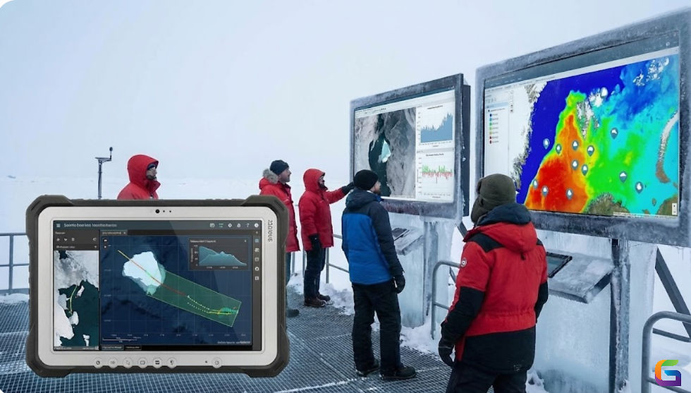
The next-generation approach to geospatial analytics, known as "Geospatial 2.0," involves incorporating real-time, cloud-native, and AI-powered technologies into geospatial data pipelines. It illustrates how dynamic, scalable, and intelligent geospatial platforms have replaced desktop GIS products.
The following are important technologies that support Geospatial 2.0:
Cloud computing platforms: Amazon SageMaker, Microsoft Planetary Computer, and Google Earth Engine
Frameworks for big spatial data: RasterFrames, GeoMesa, and GeoTrellis
AI/ML models: Deep learning models for satellite images object detection, segmentation, and prediction
Microservices and APIs: RESTful endpoints for web-based geospatial services
Geospatial analytics streaming: temporal-spatial event processing, Kafka, and Spark Streaming
Open data standards: GeoParquet, OGC APIs, and STAC
An online geospatial analysis (GeoAI) platform like GeoWGS84.ai
By eliminating the limitations of old GIS tools, Geospatial 2.0 enables enterprises to analyse on a global scale through automated ingestion, model-driven reasoning, and cloud-deployed visualizations.
Key Differences: GIS vs Geospatial 2.0
Feature | Traditional GIS | Geospatial 2.0 |
Architecture | Desktop or client-server | Cloud-native & distributed |
Scalability | Limited to local resources | Horizontal scaling via cloud |
Data Ingestion | Manual import/export | Automated pipelines (ETL, APIs, webhooks) |
Data Types | Primarily structured vector/raster | Structured + unstructured + real-time streams |
Processing | Batch processing | Real-time, stream, and batch processing |
Interoperability | File-based, proprietary formats | API-driven, standards-based (OGC, STAC) |
Analysis Tools | Rule-based, GUI-driven | AI/ML-based, code-driven (Python, Java, R) |
User Interface | Desktop GUI | Web-based dashboards, notebooks, and APIs |
Collaboration | File-sharing or enterprise GIS servers | Cloud sharing, version control, CI/CD for geospatial models |
Use Cases: When to Use GIS vs Geospatial 2.0
GIS is Perfect for:
Accurate local and regional mapping
Cadastral management and adherence to regulations
Designing and publishing maps by hand
Air-gapped systems and offline settings
Geospatial 2.0 Excels At:
Environmental monitoring at the planetary scale (e.g., climate modelling, deforestation)
IoT integration for smart cities with real-time geospatial streams
Using drones and satellite data to automatically detect crop health
Risk assessment using AI in disaster response
Emerging Tech Stack for Geospatial 2.0
Cloud infrastructure: Google Cloud Run, Azure Synapse, and AWS Lambda
Formats & Data Lakes: Cloud-Optimized GeoTIFF (COG), MrSID, Delta Lake, and GeoParquet
ML Libraries: Scikit-mobility, TensorFlow Earth, and PyTorch Geospatial
Tools for Visualization: Mapbox GL JS, Deck.gl, Kepler.gl, and CesiumJS
PostGIS, Google BigQuery GIS, and ElasticGeo are geospatial databases.
Cloud-based online geospatial analysis (GeoAI) platform like GeoWGS84.ai
The future of geographical data science is represented by Geospatial 2.0, even though classic GIS is still essential for many geospatial jobs. It prioritizes intelligence, scalability, and automation, allowing for real-time decision-making across enormous, intricate datasets. Adopting Geospatial 2.0 is not just a technical improvement but also a strategic necessity for businesses seeking to do rid with manual processes and static maps.
For more information or any questions regarding the Geospatial 2.0 and GIS, please don't hesitate to contact us at
Email: info@geowgs84.com
USA (HQ): (720) 702–4849
(A GeoWGS84 Corp Company)


Comments