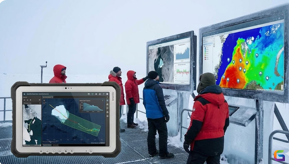
Geospatial Analysis of Drone Data for Precision Mapping & Environmental Insights
- GeoWGS84

- Aug 14, 2025
- 3 min read
Drones are now essential tools for environmental monitoring and precise mapping in the era of sophisticated geospatial technologies. The visualization, quantification, and interpretation of spatial phenomena by researchers, urban planners, and environmental scientists is being revolutionized by the integration of drone-captured data with advanced geospatial analysis methods. This article explores the technical facets of geospatial analysis with drone data and emphasizes how it may be used for environmental insights and precise mapping.

Understanding Drone Data for Geospatial Analysis
Large volumes of geospatial data are produced by drones fitted with multispectral, LiDAR, and high-resolution RGB sensors. When properly processed, this raw data provides unmatched precision for environmental assessments and mapping. Important categories of drone data consist of:
Photogrammetry Data: Structure from Motion (SfM) techniques are used to map in two and three dimensions using high-resolution aerial pictures.
Dense 3D point clouds from LiDAR Data: Light Detection and Ranging are crucial for urban planning, canopy study, and terrain modelling.
For precision farming and environmental monitoring, multispectral and hyperspectral imagery records the spectral characteristics of soils, water bodies, and vegetation.
Workflow for Geospatial Analysis of Drone Data
To derive useful insights from drone data, a strong geospatial analytic methodology is essential:
Data Acquisition & Georeferencing
Proper drone flight planning guarantees the best possible coverage and overlap. Drones with GPS capture geographical metadata, allowing LiDAR point clouds and imagery to be precisely georeferenced.
Data Preprocessing
Orthomosaic Generation: Stitching photos into high-resolution orthomosaics using photogrammetric processing programs like Pix4D or Agisoft Metashape.
Point Cloud Filtering: LiDAR point cloud classification, noise reduction, and outlier elimination.
Radiometric Calibration: To guarantee precise vegetation indices such as NDVI and NDRE for multispectral data.
Spatial Data Integration
To improve spatial context, drone data is frequently combined with pre-existing GIS layers, DEMs, and satellite photos. Large-scale processing is made easier by cloud-native platforms like Google Earth Engine or geospatial databases like PostGIS.
Geospatial Analysis Techniques
Creating digital elevation models (DEMs), slope maps, and hydrological flow models are examples of terrain and surface analysis.
3D modelling and volume calculations are essential for mining, forestry, and construction monitoring.
Vegetation and Environmental Assessment: Classifying land cover, estimating biomass, and monitoring health using spectral indices.
Change Detection & Temporal Analysis: Using time-series drone datasets, identify urban growth, deforestation, or seasonal vegetation changes.
For geospatial analysis, a platform such as GeoWGS84.ai can be utilized.
Visualization & Decision Support
Using sophisticated visualization tools such as ArcGIS Pro, QGIS, or CesiumJS, stakeholders can work with LiDAR datasets, 3D models, and orthomosaics. Predictive environmental analytics is further improved by integration with AI/ML models.
Applications of Drone-Based Geospatial Analysis
Precision Mapping
Geospatial analysis and high-resolution drone photography create precise maps at the centimetre level for cadastral surveys, infrastructure inspection, and urban planning.
Environmental Monitoring
Real-time ecosystem monitoring, including wetland health, river morphology, forest canopy density, and agricultural field performance, is made possible by multispectral and LiDAR data.
Disaster Management & Risk Assessment
Drone data geospatial analysis helps with post-disaster damage mapping for quick response, landslide risk assessment, and flood-prone area assessment.
Climate & Sustainability Studies
Temporal drone datasets help with carbon stock calculation, climate modelling, and sustainable land-use practice monitoring.
Challenges & Considerations
Data Volume & Storage: Terabytes of high-resolution data are produced by drone surveys, necessitating scalable processing and cloud-based storage.
Regulatory Compliance: Strict adherence to privacy laws, no-fly zones, and flight licenses is required.
Complexity of Integration: Combining disparate information (LiDAR, RGB, multispectral) necessitates sophisticated geospatial processing abilities.
Accuracy Validation: To guarantee accurate mapping, ground control points (GCPs) and drones with RTK capabilities are essential.
Environmental insights and precision mapping are being redefined by the geospatial analysis of drone data. Organizations may monitor ecological systems, increase planning accuracy, and make well-informed decisions by utilizing multispectral information, LiDAR point clouds, and high-resolution photography. The next wave of environmental intelligence and precision mapping will be driven by the combination of UAV technology and cutting-edge GIS approaches as drones get more complex and geospatial analytics become more widely available.
For more information or any questions regarding the drone data, please don't hesitate to contact us at
Email: info@geowgs84.com
USA (HQ): (720) 702–4849
(A GeoWGS84 Corp Company)


Comments